
Implementation outcomes:
Interactive Map
of Emerald Network of Ukraine 2021
Interactive map of Emerald Network of Ukraine 2021 (Base map: Open Map).At the top left is the legend of the map and layers for management.
Interactive map of Emerald Network of Ukraine 2021 ( Base map: Imagery Hybrid) and Sentinel-2 10m Land Use/Land Cover Change from 2018 to 2021. It layers displays change in pixels of the Sentinel-2 10m Land Use/Land Cover product developed by Esri, Impact Observatory, and Microsoft. Available years to compare with 2021 are 2018, 2019 and 2020.At the top left is the legend of the map and layers for management.
Interecocentre, as PIU, has implemented the Joint Programme between the Council of Europe and the European Commission entitled “Support for the implementation of the Convention on Biological Diversity Programme of Work on Protected Areas in the EU Neighbourhood Policy East Area: Extension of the implementation of the EU’s Natura 2000" in the period from 2009 to 2013.
The Interecocentre formed the team of experts from scientists, NGO representatives and the Ministry of Environmental Protection and Natural Resources of Ukraine performed the following tasks of the Joint Program of the Council of Europe/European Commission:
The Interecocentre formed the team of experts from scientists, NGO representatives and the Ministry of Environmental Protection and Natural Resources of Ukraine performed the following tasks of the Joint Program of the Council of Europe/European Commission:
Administrative arrangement 2011 and Annex 1. Description of the Actions
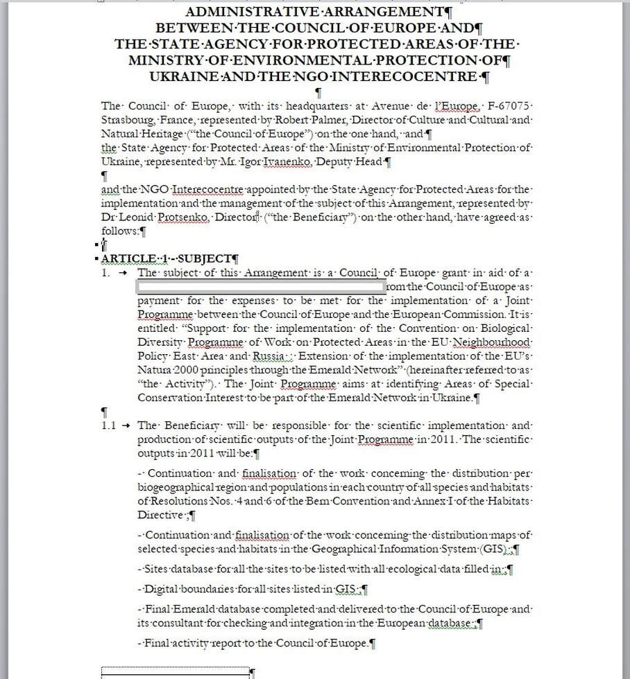
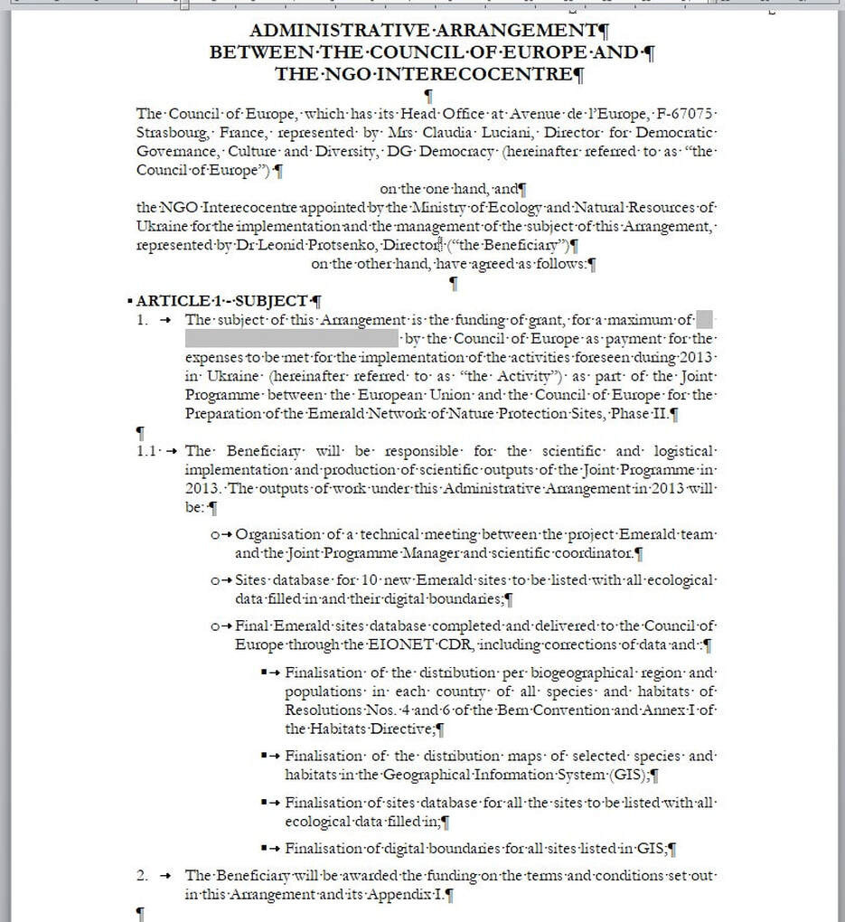
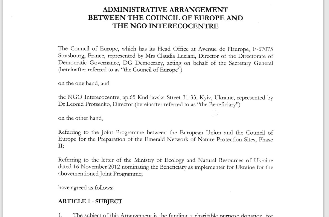
Administrative arrangement 2013 and Annex 1. Description of the Actions
Administrative arrangement 2015 and Annex 1. Description of the Actions

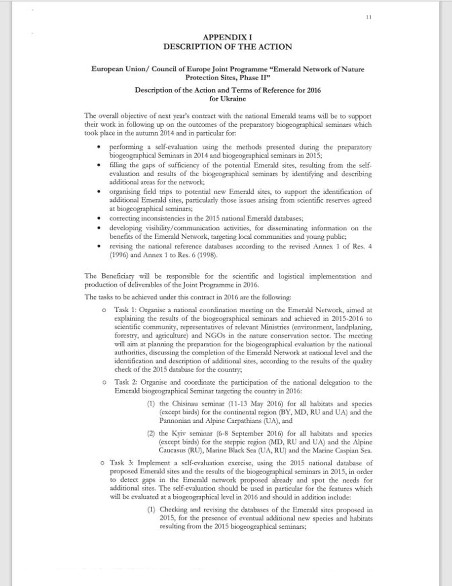

Administrative arrangement 2016 and Annex 1. Description of the Actions

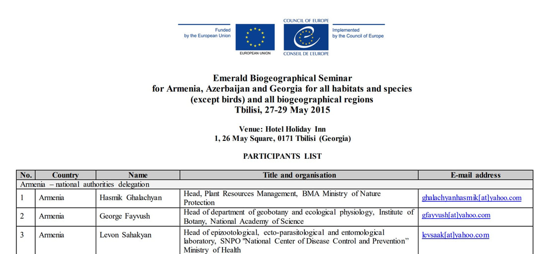
Emerald Network Biogeographical Seminar for all habitats and species (except birds) for the Steppic region (the Republic of Moldova, the Russian Federation and Ukraine) the Marine Black Sea (Ukraine) and the Marine Caspian Sea Kyiv, 6-8 September 2016 (Ukraine)
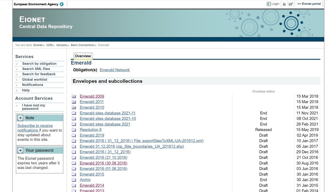
Interecocentre from 2009 to 2016 submitted the database and GIS map file for the Emerald Network in Ukraine to EEA through the Eionet Portal https://cdr .eionet.europa.eu/ua/bc/emerald/
The Emerald Network database for Ukraine, prepared by a team of Interecocenter experts, was annually checked by EU experts in the report "Quality control of the delivery of the Emerald Sites 2013 database by Ukraine"
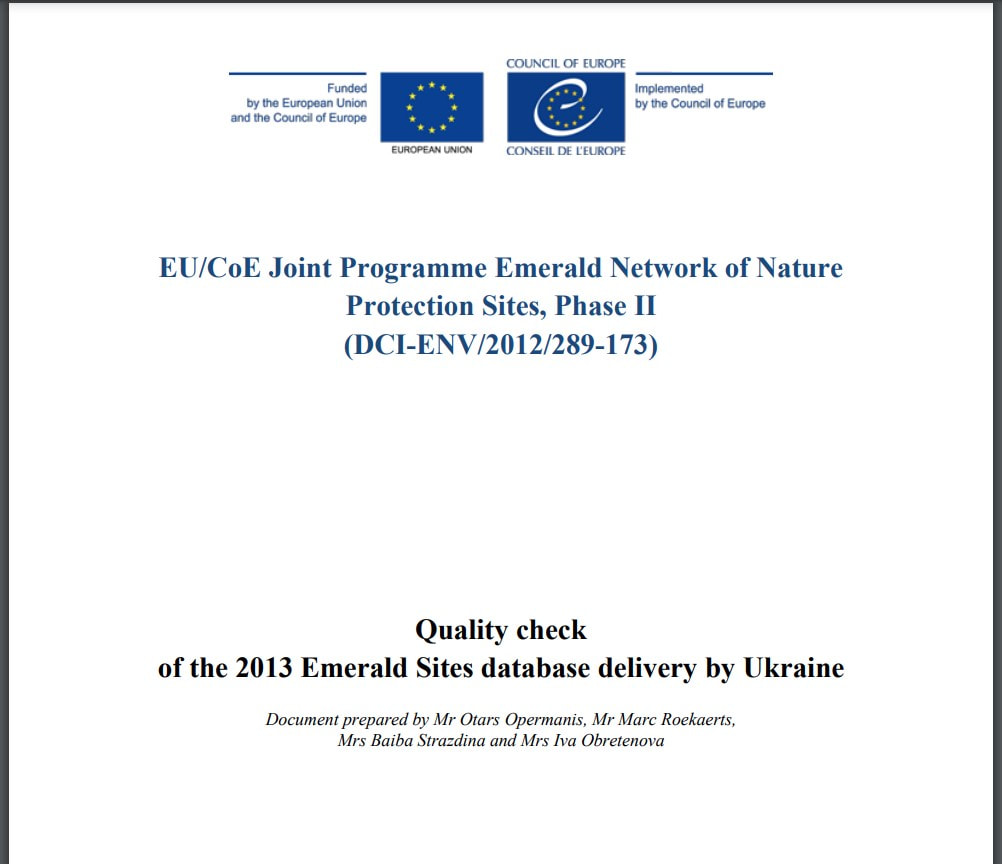
EU/CoE Joint Programme Emerald Network of Nature Protection Sites, Phase II (DCI-ENV/2012/289-173)
Quality check of the 2013 Emerald Sites database delivery by Ukraine
Document prepared by Mr Otars Opermanis, Mr Marc Roekaerts, Mrs Baiba Strazdina and Mrs Iva Obretenova
https://pjp-eu.coe.int/emerald-network/images/uy_quality_check_emerald_database_2013.pdf
Since 18 November 2016, three countries, Switzerland, Belarus and Ukraine, have officially adopted Emerald sites on their territories. These sites have successfully passed the biogeographical assessment for their sufficiency, as foreseen in Phase II of the Network constitution process. National authorities in the countries are now considering the management and conservation measures they need to put in place for these sites. They equally continue identifying additional areas suitable to join the Network on their territories.
List of officially adopted Emerald sites (last updated in November 2016)
For Ukraine:
1.)271 Emerald Network Standard Data Form for Ukraine according of Annex 1 to Resolution No. 5 (1998)
2.) 271 Maps of Emerald Sites of Ukraine
http://wab.discomap.eea.europa.eu/webappbuilder/apps/27/
3.) Addition map with 271 Maps of Emerald Sites of Ukraine
arcg.is/0Ku1aS
2.Support material to the use of the Emerald Network Softfare SDF:
- New Emerald Network Software and guidance on its intallation and use
- Emerald Network Standard Data Form [Revised Annex 1 to Resolution No. 5 (1998)]
- European biogeographical regions' map, as adopted by the Standing Committee to the Bern Convention, December 2010
- Digital version of the European biogeographical regions' map, developed and maintained by the European Environment Agency
- Correspondence table between the old and new version of Annex I of Resolution 4 (1996) of the Bern Convention on endangered natural habitat types
3.Final conclusions from Emerald Biogeographical evaluation Seminars
- Emerald biogeographical Seminar for bird species for Belarus, Republic of Moldova, the Russian Federation and Ukraine, 24-25 November 2015, Minsk (Belarus)
- Birds - reference list and final conclusions
- Emerald Network biogeographical Seminar for all habitats and species (except birds) for the Continental Region (Belarus, the Republic of Moldova, the Russian Federation and Ukraine) and the Pannonian and Alpine Carpathians (Ukraine), 11-13 May 2016, Chisinau (Republic of Moldova)
- Animals - reference list and final conclusions
- Habitats - reference list and final conclusions
- Plants - reference list and final conclusions
- Emerald Network Biogeographical Seminar for all habitats and species (except birds) for the Steppic region (the Republic of Moldova, the Russian Federation and Ukraine), the Alpine Caucasus (the Russian Federation), the Marine Black Sea (Ukraine, the Russian Federation) and the Marine Caspian Sea, 6-8 September 2016, Kyiv (Ukraine)
- Animals - reference list and final conclusions
- Habitats - reference list and final conclusions
- Plants - reference list and final conclusions
Reference documents adopted by the Standing Committee to the Bern Convention
- Resolution No. 4 (1996) listing endangered natural habitats requiring specific conservation measures (including revised Annex I to Resolution No. 4 (1996), adopted in 2014 by the Standing Committee)
- Resolution No. 5 (1998) concerning the rules for the Network of Areas of Special Conservation Interest (Emerald Network)
- Resolution No. 6 (1998) listing the species requiring specific habitat conservation measures (including revised Annex I to Resolution No. 6 (1998), adopted in 2011 by the Standing Committee)
- Resolution No. 8 (2012) on the national designation of adopted Emerald sites and the implementation of management, monitoring and reporting measures
- Revised Calendar for the implementation of the Emerald Network of Areas of Special Conservation Interest (2011-2020)
- Revised criteria for assessing the National Lists of proposed Emerald sites (ASCIs) at biogeographical level and procedure for examining and approving Emerald candidate sites (adopted in 2013 by the Standing Committee)
- Recommendation No.157 (2011) on the status of candidate Emerald sites and guidelines on the criteria for their nomination
- Recommendation No. 172 (2014) interpreting certain provisions of Resolution No. 6 (1998) of the Standing Committee to the Bern Convention
- Information Form for new Species or Habitats to be added to the Bern Convention lists (Res. 4 (1996) and Res. 6 (1998)
- Interpretation manual of the habitats listed in Resolution No. 4 (1996) - T-PVS/PA(2015)9E
- The Emerald Network: explanatory document and compilation of relevant texts
